Log in
Set up some fieldwork investigations
You can design your own self-guided excursions to deliver to your students at public waterway sites. You'll investigate the value of water in the urban environment. Use your observational fieldwork skills to create field sketches and maps to help understand changes over time. Use our Alexandra Canal example as a guide.
What is a waterway?
It's easy to identify Sydney Harbour and our great beaches as waterways, but have you thought about the bays, rivers, creeks, wetlands and even stormwater drains that can be found in every suburb? They're waterways, too.
Over time, as Sydney has grown, our value and use of waterways has changed. Natural creeks were turned into canals for transport of goods and people. Some creeks were moved so we could build houses and industry. Some creeks have become hidden underground.
As our knowledge improves, technology advances and attitudes change. This means that we place different values on our surrounding environment, such as:
- need – source of water for sustaining life
- function – use of water for industry processes and transport
- liveability – aesthetic value, recreation and wellbeing
You can see our stormwater systems with our stormwater catchment map and learn more about how we manage stormwater in our urban environment.

Natural creeks can be found in urban environments in parks and reserves.
Creeks have been turned into stormwater drains to move water away from homes.
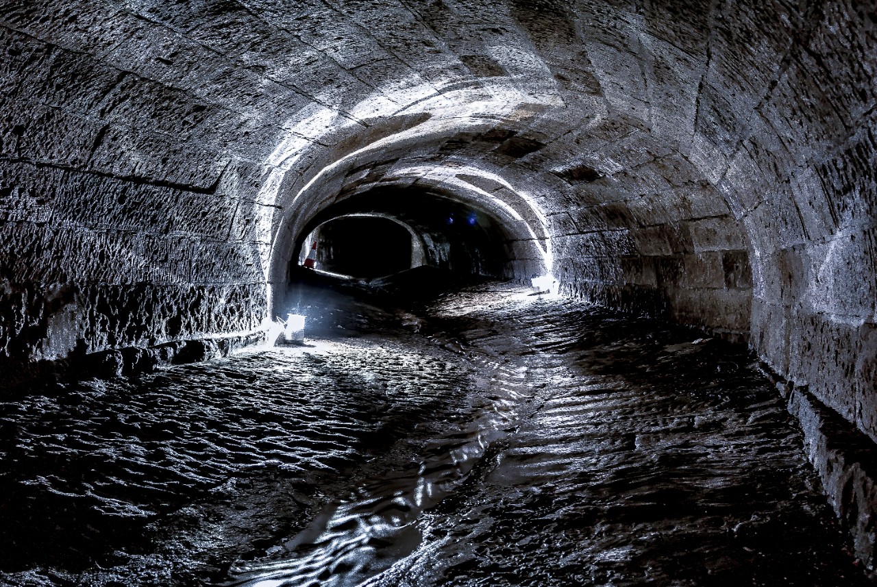
Some waterways have been hidden underneath the city streets.
How do you design a waterway fieldwork investigation?
Set your aim
The best way to start is to identify an aim for your waterway based fieldwork investigation. For example:
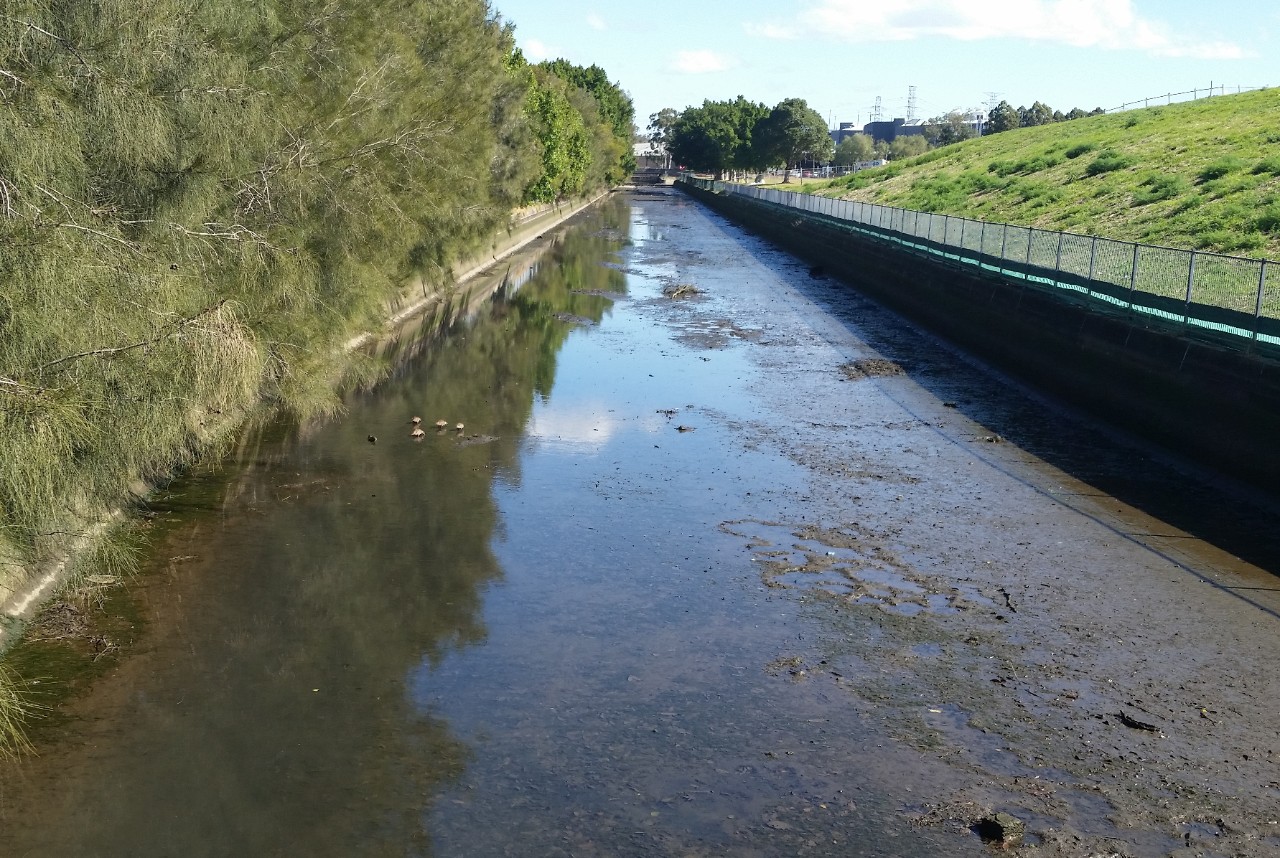
- To identify the value of Alexandra Canal improvement to recreational use of Tempe Reserve.
- To investigate the improvement of water quality to the recreational value of the Nepean River from the recycled water discharge into Boundary Creek.
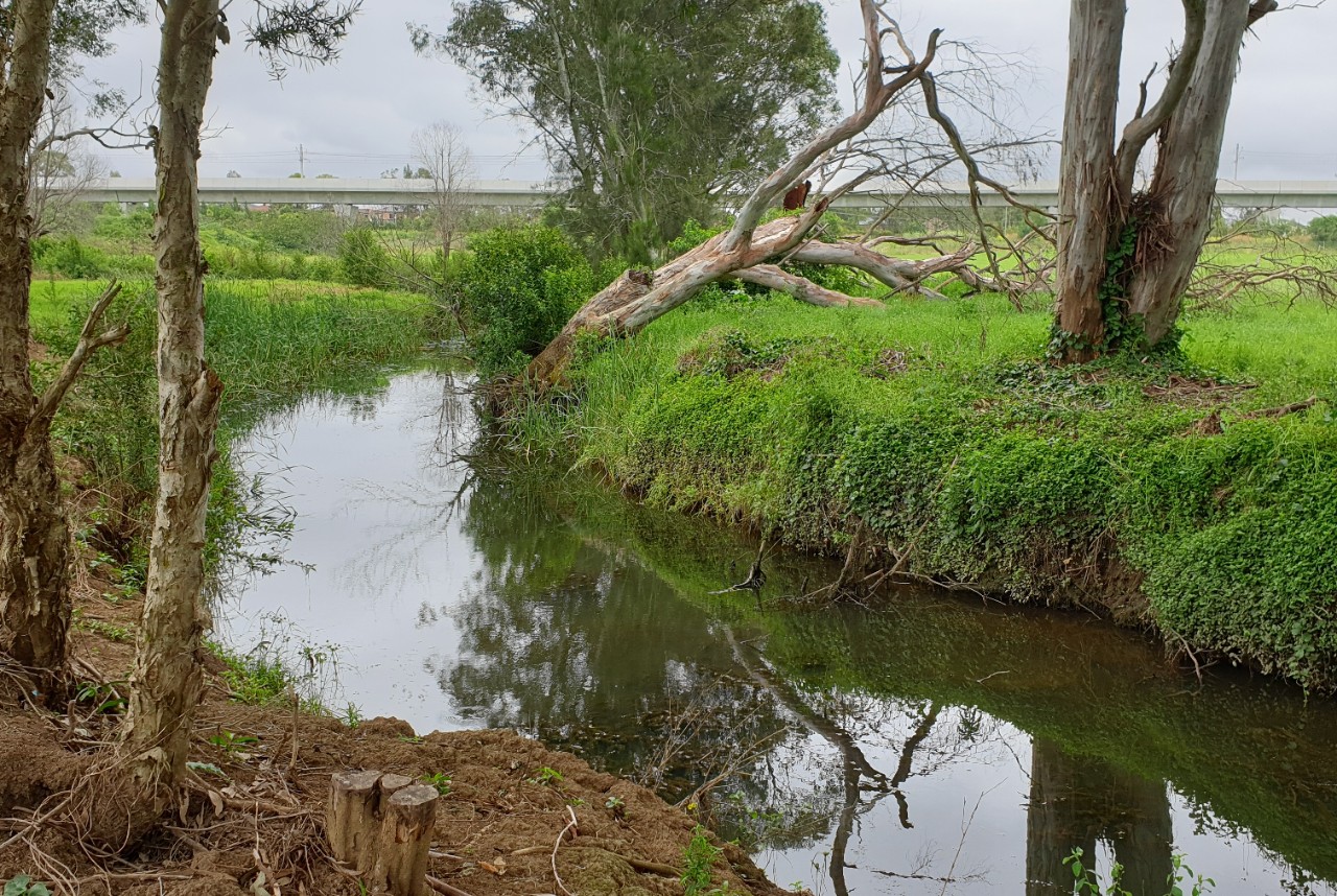
- To evaluate the improved public value of Johnstons Creek from the completed naturalisation project.
Find a waterway to investigate
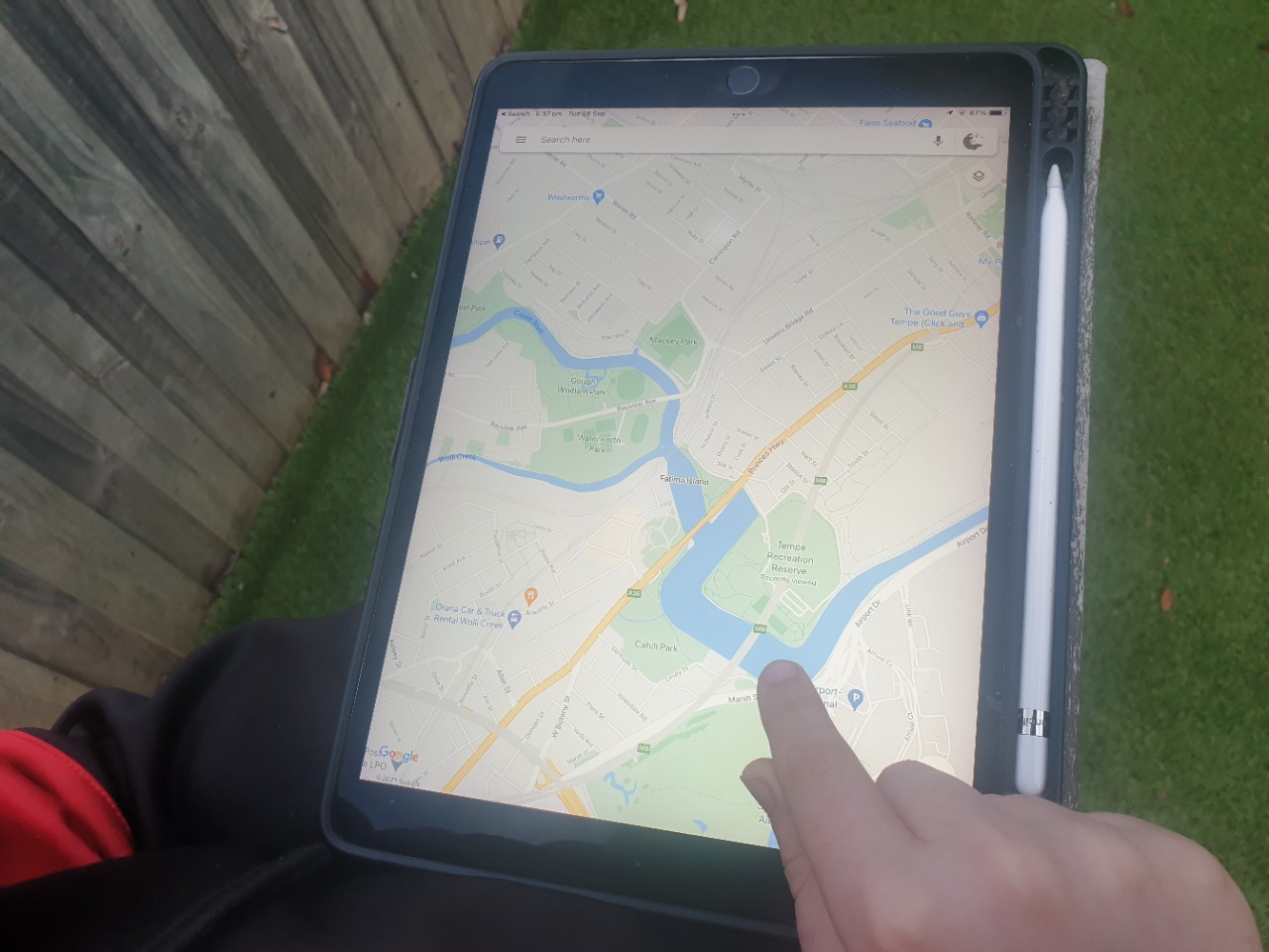
You may like to investigate your closest waterway. Simply find where you are on google maps and look for the blue bits, these are waterways.
Zoom in and take a closer look.
What type of waterway is it? Is it an ocean, bay, river, creek? Is it a stormwater drain? Is it man-made or natural?
Why do some creeks have straight sections?
Research your waterway
Research the changing values and uses of your water way over time by:
- looking at the information our website about stormwater management, current projects and heritage conservation
- contacting the local council and ask about their waterway/stormwater management plans
- finding out about your local First nations community group to learn about water knowledge in your area
- contacting your local historical society for images or maps of the area in the past showing the waterway/stormwater drain.
With this information you can create a timeline of human interactions.
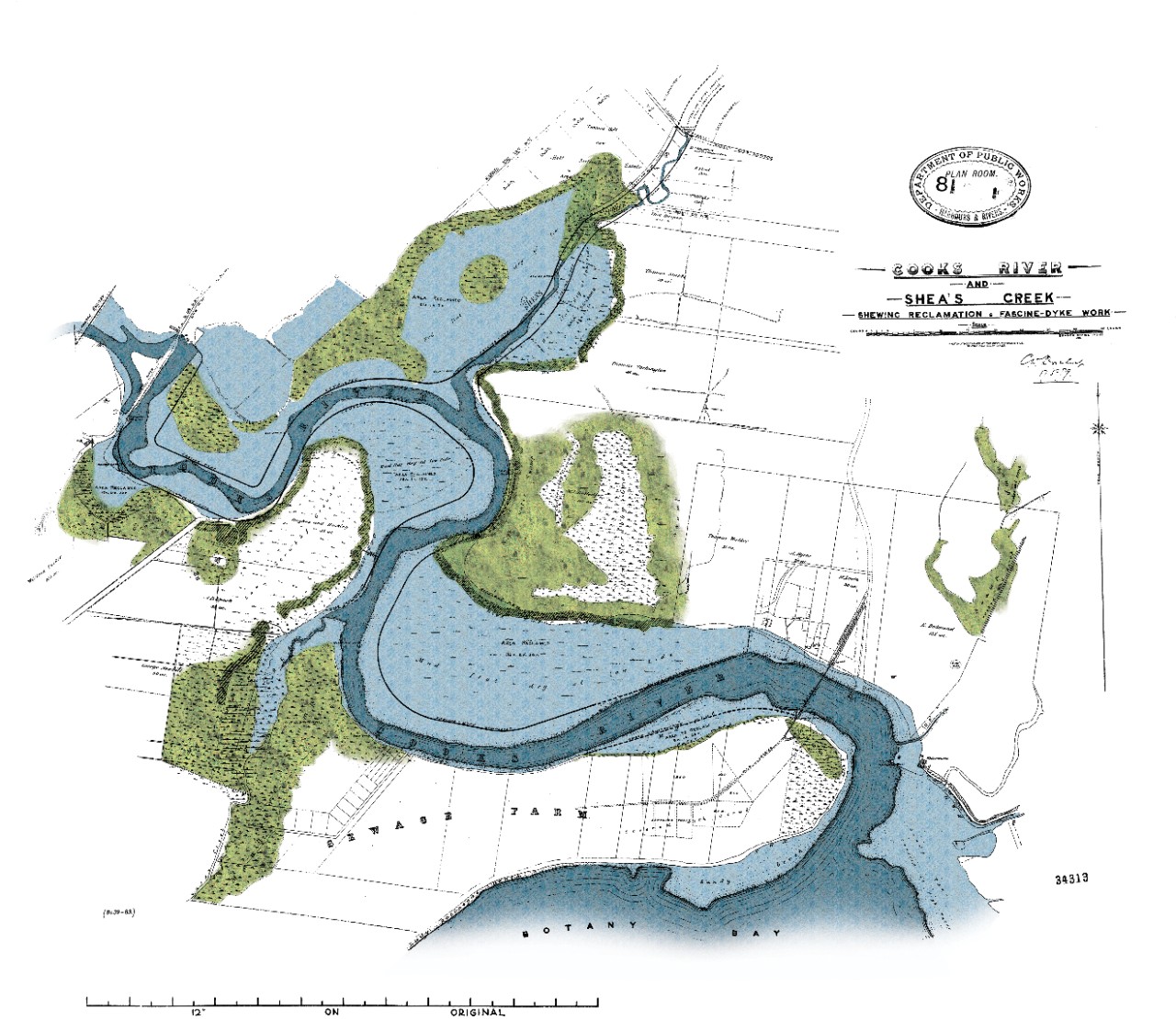
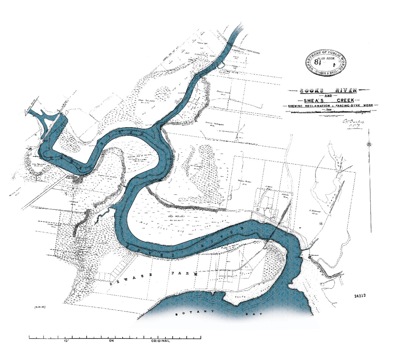
Overlay map of the Cooks River and Sheas Creek (now Alexandra Canal). It shows the original path of Sheas Creek and the river.
Overlay map of the Cooks River and Sheas Creek showing the straightening of the creek to turn it into Alexandra Canal.
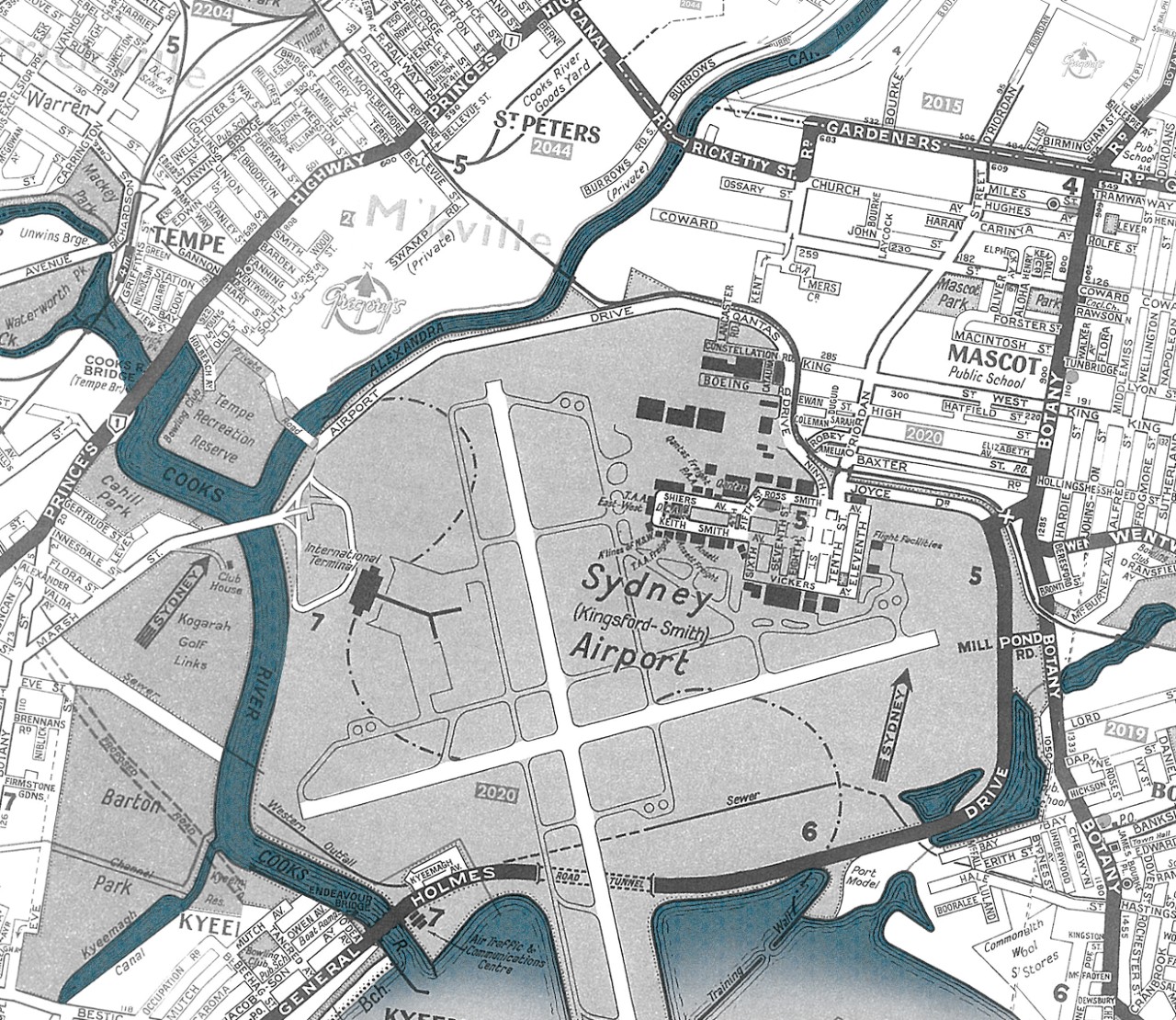
Map showing the new shape of Alexandra Canal and Cooks River after the airport was built.
Do your fieldwork
Fieldwork is an important way to observing, measuring, collecting and recording data, developing and conducting surveys about the value of water in our urban environment.
Investigate some of the fieldwork methods below to get you started.
What fieldwork methods should you use?
When planning your fieldwork, it's important to select fieldwork investigation methods or research tools that will help you gather data to meet your aim.
You don't need fancy equipment to do quality fieldwork. You can use your skills of observation. Here are some example of observational methods you can use to do a waterway based fieldwork investigation.
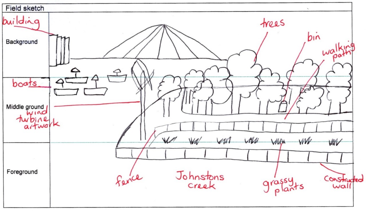
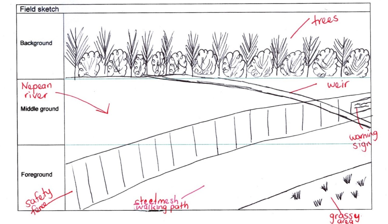
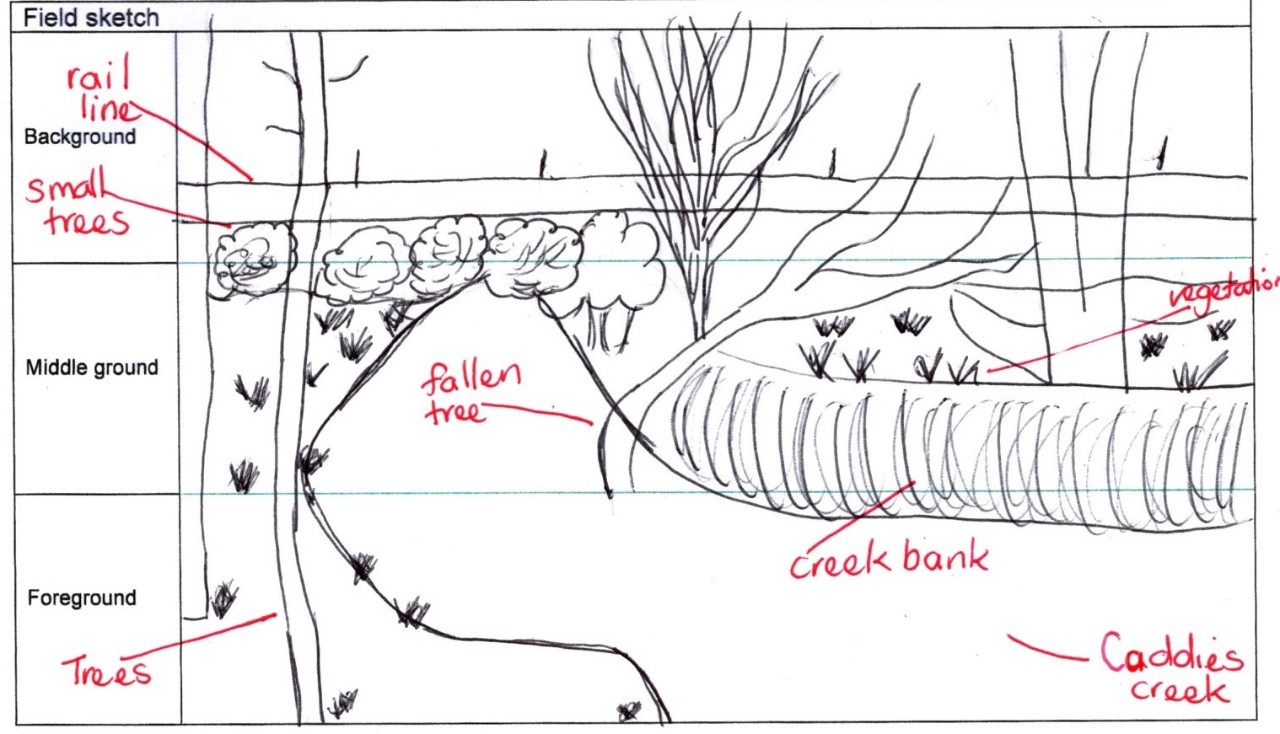
Field sketch
Survey
Photos
Sensory mapping
Weather
The aim of a field sketch is to identify the waterway and make notes about the features that influence the way we enjoy this space. You can look back on field sketch with notes and recall more than a photo.
Some questions to think about while doing your sketch.
- What features make the spot visually appealing?
- Why do people like doing activities close to the water?
- What recreational activities could be more enjoyable with a nice view of water.
The first thing to remember is that you do not have to be an artist to do a field sketch. Break up your picture into 3 sections: foreground, middle ground and background.
Johnstons Creek
Nepean River
Caddies Creek
By doing surveys, we can identify human activities and natural features such as plants and animals to help us build a picture of the ways the waterways are being used.
Litter survey
A litter survey concentrates on one human interaction. There are 2 parts to a litter survey.
- making a tally of the types of litter found in an area
- mapping the distribution of the litter.
By doing a litter survey we can:
- find out what sort of litter is there
- see if that litter may be causing a problem
- work out where the litter came from
- see if litter makes the place look/feel bad.
You can use our Fieldwork investigation – litter survey to help you create your own litter survey.
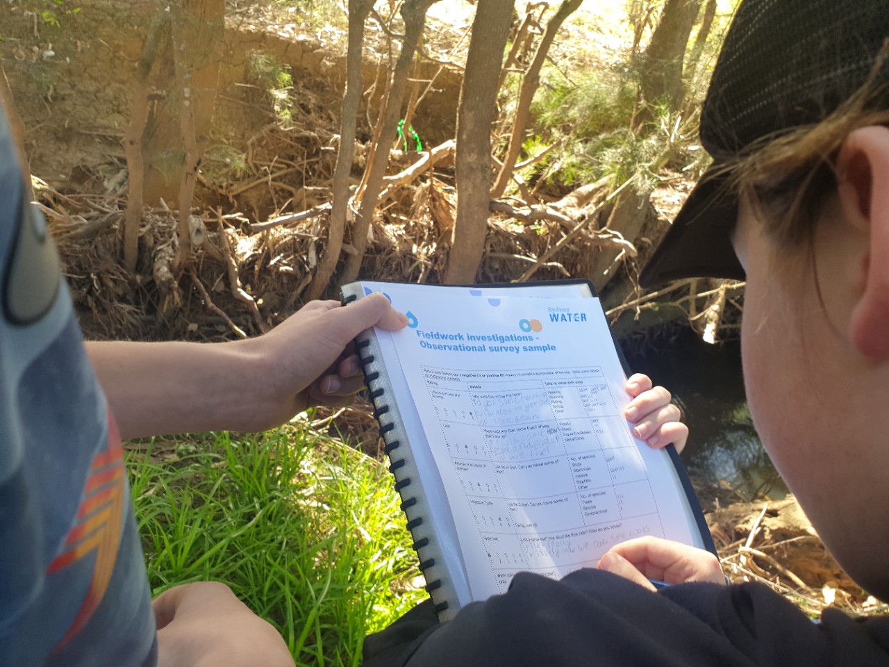
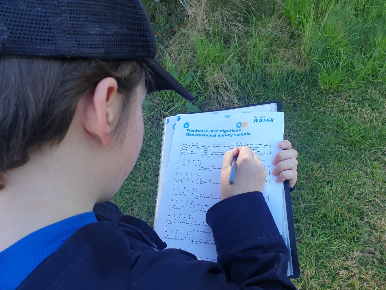
Observational survey
You could do an observational survey to identify a broad range of information from a site on investigation. It can help you to answer a question such as:
- What does it tell us if we see lots of animal evidence in the area?
- How can we assess the value of the waterway by watching how people experience it?
- How can the amount of litter in a place change our opinion about it?
You can use our Fieldwork investigation – observational survey to help you create your own survey.
Some questions to think about while doing your survey:
- What activities people are doing in and around the waterway - are they participating in recreation or exercising?
- What are the plant species growing? Are they weeds or natives?
- What types of animals that can be found? What evidence do you see of animals in the area?
- What evidence can be seen of human interactions such litter found in the area and built features such as paths, jettys, sea walls, drains or boat ramps.
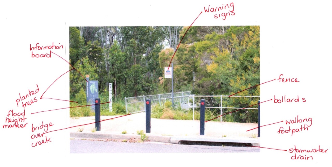
Photos can be used as a fieldwork investigation tool in several different ways. By using this method you will:
- Observe and record data to help explain how interactions and connections between people, places and environments result in change.
- Identify differences in people's perceptions about places and how that influences their views about the protection of places.
You can annotate (make notes) on your photo to record your thoughts and observations. Using annotated photographs allows you to label the evidence you can see showing the changing value of this waterway over time.
Some questions to think about while doing your annotated photograph:
- Are there any natural landscape features?
- What type of waterways is this?
- Is there any evidence of the different values placed on this waterway over time?
- Can you imagine this space in the future?
- What do you value in this space? Was it the same or different to your peers? How might this change how we interact and protect the space?
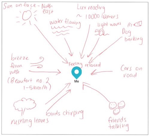
Sensory mapping uses various senses to map the sounds and feeling in the area. Use an online guide before going into the field. It's good practice to go into the playground to try this first.
Mapping our experiences of an area this way allows us to show how people are affected by the environment and present it as an alternative form of communication.
You can support thoughts and feelings of sensory mapping by recording atmospheric readings as well, such as wind speed, humidity, sound decibel reading or light levels.
Some questions to think about while doing your sensory map:
- What role does water play in the way you’re feeling?
- How important are your other senses when thinking about what you like about a place?
- Are there other ways you could record or quantify what you’re thinking and feeling?
You can use our Fieldwork investigation – sensory mapping as a guide.
Climate and weather affect the water cycle and the amount of rainfall we get.
- Weather is the daily conditions in the atmosphere like how hot, wet, windy or cloudy it is.
- Climate is long-term weather patterns. If an area is always hot and dry, for example, we could say it is has a desert or dry climate.
Climate scientists predict that the climate in Sydney will change and rainfall will become more unpredictable. Changes in climate patterns have a more serious impact than changing weather patterns, because the effects are over a longer time and a larger area.
Including weather and climate studies in our waterway fieldwork investigations can help us understand the value of waterways and the outdoor spaces for people in an urban environment.
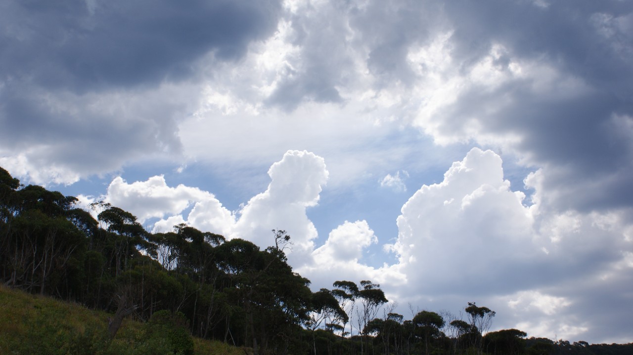
Clouds can tell us a lot about the way we enjoy open spaces and waterways.
Some investigation methods you can use to evaluate the weather in your fieldwork locations are:
What examples are there?
Alexandra Canal
We have put together some of the fieldwork advice from this page to create a self-guided excursion for you. It is based on Alexandra Canal at Tempe Reserve Tempe, Sydney.
The fieldwork investigation is linked to the Stage 4 Geography topic 'Water in the World – the value of water'. Students will:
- investigate waterway management in Sydney
- recognise the changing value of water resources over time
- understand how we protect public health and the environment.
You can download all the resources you need here:
Self-guide fieldwork lesson plan Alexandra Canal Tempe Reserve – between 4 and 6 lessons, including a 2- to 3-hour excursion.
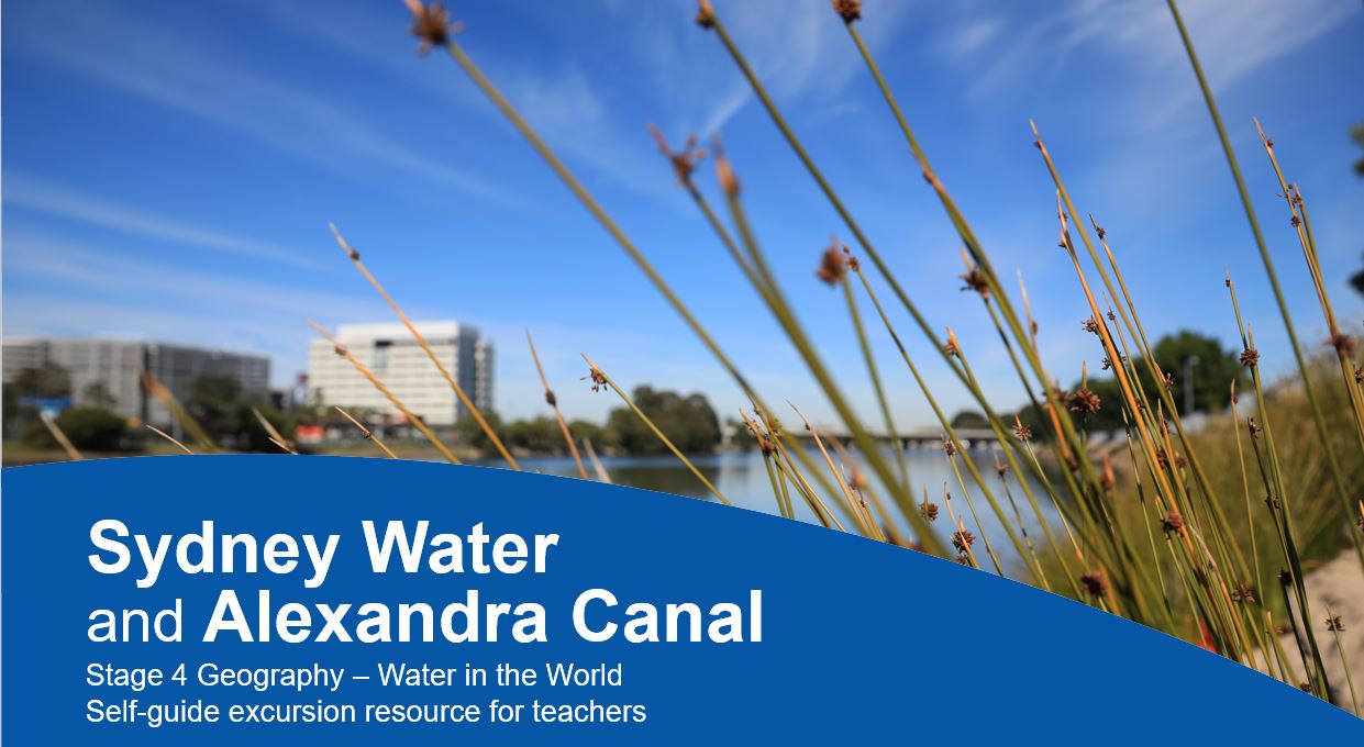
Sydney Water and Alexandra Canal – presentation
Alexandra Canal delivery notes – providing questions (and answers) to get students thinking – includes additional information about the site, links to other online resources, responsibilities of Sydney Water and definitions of water-related terms
Alexandra Canal – worksheet
Alexandra Canal Changes Over Time – worksheet
Alexandra Canal Future Planning – worksheet
Alexandra Canal worksheet teacher answers – with additional fieldwork hints, tips and resource links